
Powerful Features for Critical Operations
The only comprehensive TAK-ArcGIS integration with enterprise-grade capabilities built for mission success
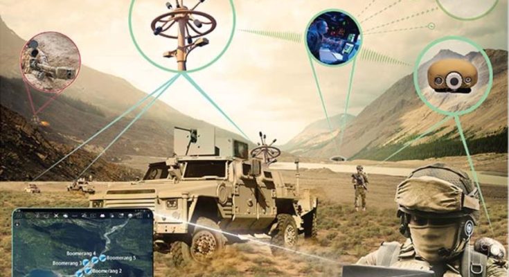
Multi-Format Exchange
Support for KML/KMZ, CoT XML, GeoJSON, Shapefiles, GPX, and TAK Mission Packages. Convert and sync data seamlessly across platforms.
Real-Time Collaboration
WebSocket-based live messaging, chat integration, location tracking, and emergency alerts. See field updates instantly in your command center.
Enterprise Security
PKI certificate authentication, encrypted storage, SSL/TLS communications, and role-based access control. FIPS 140-2 compliant.
Edge Mesh Networking
Meshtastic LoRaWAN integration for 25km range without infrastructure. Multi-hop routing, store-and-forward, and battery-optimized communications.
Survey-Grade GNSS
RTK positioning with 2cm accuracy. Multi-constellation support (GPS, GLONASS, Galileo, BeiDou) with NTRIP real-time corrections.
Trusted by Organizations That Can't Afford to Fail
From defense operations to emergency response, TAK Integration delivers mission-critical reliability


Voice Interoperability at Its Best
Connect any device, any network, anywhere. Cellular. Wi-Fi. IP. Radio. Mesh.

Bridge Radio Systems
Connect any radio network to any other radio network for seamless radio interoperability.

Connect Radios and IP Devices
Connect any radio to any IP-connected or mobile device. Extend radio coverage beyond network limits.

Reduce Radio Costs
Give radios to the people who need them. For everyone else—use smartphones with our PTT app.

Talk Without a Server
Disconnected voice communications at the tactical edge. No servers required. Perfect for fast-moving missions.
Mission-Ready Pricing
Choose the deployment option that fits your operational requirements
Starter
Small teams & pilot programs
- Up to 10 users
- Basic TAK integration
- Real-time sync
- Email support
Professional
Full operational capability
- Unlimited users
- Advanced TAK features
- Mesh networking
- Priority support
- Custom training
Enterprise
Custom deployments
- Dedicated infrastructure
- On-premise deployment
- Custom integrations
- 24/7 dedicated support
- SLA guarantees
Podcast Series
Explore our 4-episode series covering platform overview, AI technology, engineering insights, and business impact.
Total: 17:49 minutes of professional audio content
Democratizing Satellite Intelligence: AI-Powered Earth Observation for Everyone
Episode #1 • 10:29 min
How AI is transforming satellite imagery analysis and bringing enterprise-grade intelligence to researchers, businesses, and organizations worldwide
From Pixels to Predictions: How TerraTorch Brings Deep Learning to Satellite Imagery
Episode #2 • 2:54 min
Exploring how foundation models and transfer learning are revolutionizing satellite image analysis with browser-native AI
Building the Platform: A Technical Journey from Concept to Launch
Episode #3 • 2:34 min
Behind-the-scenes engineering story: challenges, breakthroughs, and lessons learned building browser-native satellite AI
Business Impact: ROI Case Studies Across Industries
Episode #4 • 1:52 min
Real return on investment: how organizations across industries are saving costs and making smarter decisions with satellite AI